
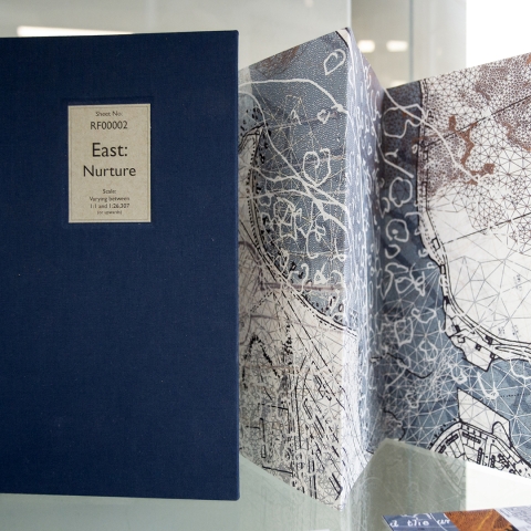
Rob French, local artist, shares extracts from a larger project, Archive for a Fragile Island, in the display case on the first floor of the University Library. The full project will be on display at the Round Tower in Old Portsmouth later this month.
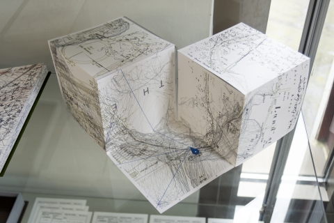
Rob explains that the artworks explore four locations around the coastline of Portsea Island. Together, they aim to form an archive of a shifting, unstable, and fragile place – one that has changed not only physically but also in terms of its role in the world. However, how reliable can an archive be in capturing the essence of such a fluid and contested place? Is what is missing as important as what is included? And does an archive say more about the archivist or their subject.
The works have been catalogued as if they were part of the University Library’s collection, and forming an archive within an archive.
The full project and installation can be viewed at the following times at the Round Tower in Broad Street:
- Wednesday 30 July – 11 am - 4 pm
- Thursday 31 July – 11 am - 4 pm
- Sunday 3 August – 10 am - 3 pm
Contributed by
Greta Friggens, Faculty Librarian (CCI) and Rob French, local artist